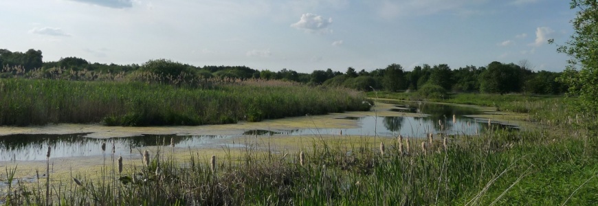
River floodplains hold a central role in supporting the status of water, nature and biodiversity conservation, climate change mitigation, and ecosystem services. They build an important link between rivers and their catchments, mainly through their water retention capacity and the lateral connectivity controlled by flood events and groundwater exchange, together with the presence of structural features such as side channels and wetlands.
The main objective of this report is to present a methodology for assessing floodplain condition in terms of extent, structure and processes on a European scale, together with the first results.
First, an ecological floodplain typology was developed by classifying floodplains according to natural abiotic factors (e.g. altitude and valley slope), which are known to govern floodplain habitat conditions but are not affected by human alterations. These factors allowed to distinguish between seven ecological floodplain types characterised by distinct habitat features. The reference conditions for assessment naturally differs between these floodplain types, and values for relevant type-specific reference conditions were identified from a set of least-disturbed floodplain sections across Europe.
Second, within each floodplain type, a set of indicators describing floodplain extent, structures and processes has been assessed by comparing the present observed habitat conditions to type-specific reference conditions at the spatial scale of river sub-catchments. The preliminary assessment results reveal clear signals of degraded floodplain condition:
-Almost 75 % of Europe’s floodplain area shows a severe reduction of floodplain extent. Severely degraded structure occurs where land use is almost entirely characterized by urban areas and agriculture, both of which contribute strongly to degrading floodplain structures as a consequence of modified river channel, drainage and dikes.
-Similarly, 41 % and 38 % of the floodplain area show severely or substantially degraded floodplain structure. Severely degraded structure occurs where land use is almost entirely characterized by urban areas and agriculture, both of which contribute strongly to degrading floodplain structures as a consequence of modified river channel, drainage and dikes.
-The floodplain processes module shows the combined integrity of physical processes expressed as base flow, degree of flow regulation and sediment transport, all of which are important for maintaining floodplain habitats and support the lateral connection between river and floodplain. The assessment shows severe or substantial alterations in 60 % of Europe’s floodplains.
These preliminary assessment results point to extensive restoration needs if floodplains are to support achieving water and conservation policy objectives. It is critical for restoration efforts to tackle improving the lateral connectivity between rivers and floodplains. Such improvements are needed in the upcoming process of implementing the 2030 Biodiversity Strategy under the European Green Deal. It includes a target to achieve 25 000 km of free-flowing rivers through the removal of barriers and restoration of floodplains and wetlands.
Recipient: EEA